Optical and Radar Remote Sensing
The biggest difficulty in using remote sensing to map habitats in tropical and subtropical areas is the high year-round cloud cover, hiding features from optical satellite imagery. There are several strategies to fill the gaps created by the clouds, for example by using images taken of the same location on different days to create a mosaic of cloud-free images. For some habitats, such as mangroves, images from radar satellite imagery, which is not sensitive to cloud cover, can be used to fill the gaps in optical imagery.
There are key differences and limitations in optical and radar satellite imagery. For example, radar satellite imagery does not penetrate in water and therefore is not useful for mapping coral reefs, yet can be powerful to map emergent structures like mangroves.
Optical Systems
Optical remote sensing imagery is sensitive to biophysical properties of the land cover type and vegetation. Satellite optical remote sensing systems receive their information from the electromagnetic radiation reflected by sunlight. Working with different wavelengths, optical sensors will be sensitive to photosynthetic vegetation (using the near-infrared spectrum) and water content.
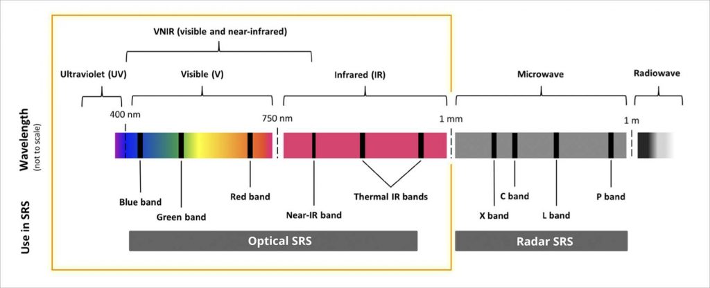
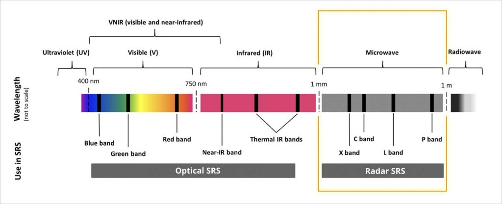
The electromagnetic spectrum (not to scale), and its use in satellite remote sensing (SRS). Source: Pettorelli et al. 2018
Satellite sensors such as the Landsat missions measure radiance in a small number of well-defined ranges of wavelengths (“spectral bands”) in the visible, near-infrared, and short-wave infrared portions of the electromagnetic spectrum from which it generates spectral signatures of the object on land.
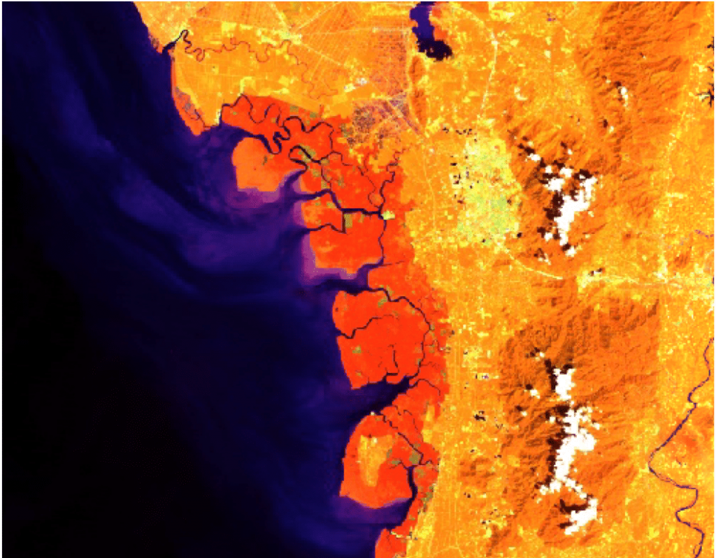
Optical Remote Sensing image of the coastline of Matang National Park in Perak, Malaysia in false-color. In dark orange are mangrove areas, with the yellow patches indicating clear cutting by villages where the land is dryer. Credit: Landsat image courtesy of the U.S. Geological Survey
Radar Systems
Interpreting imagery from radar sensors is less intuitive than for optical imagery because these sensors do not perceive color, but rather respond to surface geometry, texture, three-dimensional structure, and water content.
Radar are active sensors that produce their own microwave radiation and are capable of operating through clouds and at night. All imaging radar sensors used for remote sensing are Synthetic Aperture Radar (SAR), a form of radar that uses the motion of the radar antenna over a target region to provide finer spatial resolution than conventional stationary beam-scanning radars.
The electromagnetic spectrum (not to scale), and its use in satellite remote sensing (SRS). Source: Pettorelli et al. 2018
The different wavelengths of radar are often referred to as bands, with letter designations such as X, C, L, and P. Each band has different properties. The L band is used for biomass and vegetation mapping because of greater penetration into a forest, allowing for more interaction between the radar signal and large branches and tree trunks.
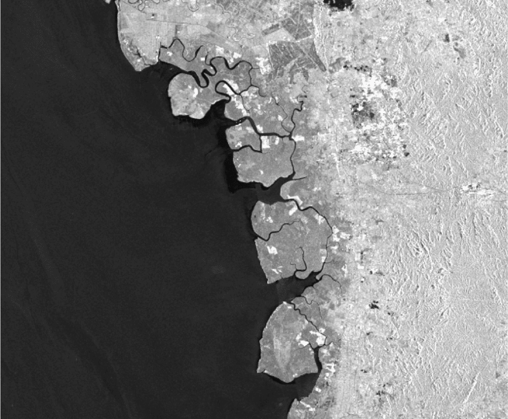
Radar remote sensing image of the coastline of Matang National Park in Perak, Malaysia. In darker grey are mangrove areas, with the white patches indicating clear-cutting by villages where the land is dryer and lacks vertical complexity. Credit: JAXA
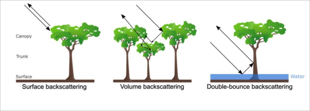
The way the radiation is received back by the sensor is called backscattering. Backscattering gives information on the type of surface and can be used to distinguish vegetation from water. The following graphic illustrates the three types of backscattering.