Coral Colony Scale Mapping
A Monitoring Tool to Track Coral Colony Survival
Subsurface mapping is the remote sensing approach with the smallest mapping footprint, however it provides the highest spatial resolution. It uses underwater photography, usually operated by snorkelers or divers, and focuses on a very small area of the reef. The approach to acquiring photos is the same as what is used when mapping with aerial drones. Close proximity photogrammetry can record very subtle changes in coral growth and loss (e.g., millimeter scale), which is a powerful tool for monitoring outplant sites.
Close proximity photogrammetry is used in combination with a technique called Structure-from-Motion (SfM) to create very high-resolution three-dimensional models of the structure of the reef. 3D models of reef structure can be used to monitor changes in rugosity, an important feature of coral reefs for coral-dependent fishes and other reef-associated organisms. In addition to structure, changes in live coral, biodiversity, disease, and impacts from invasive species can also be monitored.
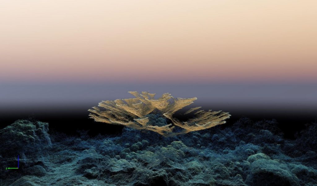
3D point cloud of Elkhorn Coral (Acropora palmata) created from hundreds of stereo photos. Image © Steve Schill
The Nature Conservancy (TNC) is leading this work in the US Virgin Islands (USVI) where they are surveying the growth of transplanted coral colonies. Read the case study below.
Case Study: Photogrammetry to Monitor Coral Restoration in the USVI
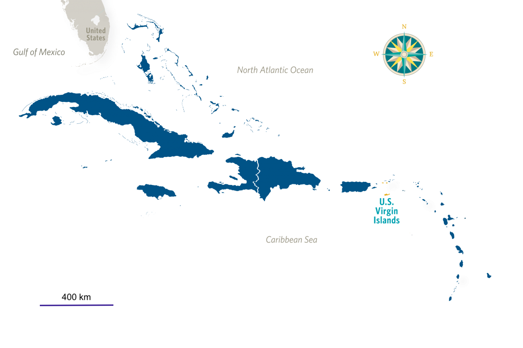
Map of the insular Caribbean highlighting the US Virgin Islands. Image © The Nature Conservancy
The USVI Coral Innovation Hub, a center to advance coral restoration innovation and science, located in St. Croix, is part of TNC’s Caribbean Coral Strategy with the overarching objective to develop and deploy scalable solutions to improve coral reef health and maximize the benefits reefs provide to people and nature in a changing climate. The USVI Coral Innovation Hub includes a land-based coral nursery and research lab, as well as several in-water coral nurseries, where sexual and asexual coral propagation approaches are being applied and tested for large-scale coral restoration. With the goal of developing novel technologies and monitoring protocols to accurately and efficiently quantify the impacts of reef conservation efforts, the USVI Coral Innovation Hub is applying photogrammetric techniques to monitor coral restoration projects in the territory.
By sampling at time-points before, during, and after restoration activities, TNC coral scientists in the USVI are combining conventional reef monitoring surveys (for example, Atlantic and Gulf Rapid Reef Assessment diver surveys of benthos and fish) with standardized close proximity photogrammetric techniques (i.e., Structure-from-Motion). The aim is to regularly collect and analyze orthomosaic and digital surface model products to monitor changes in coral restoration and control (unrestored) sites. The digital surface models, generated from stereo photos, enable the monitoring of small changes in coral growth and loss, at a millimeter scale, based on changes in the three-dimensional structure.
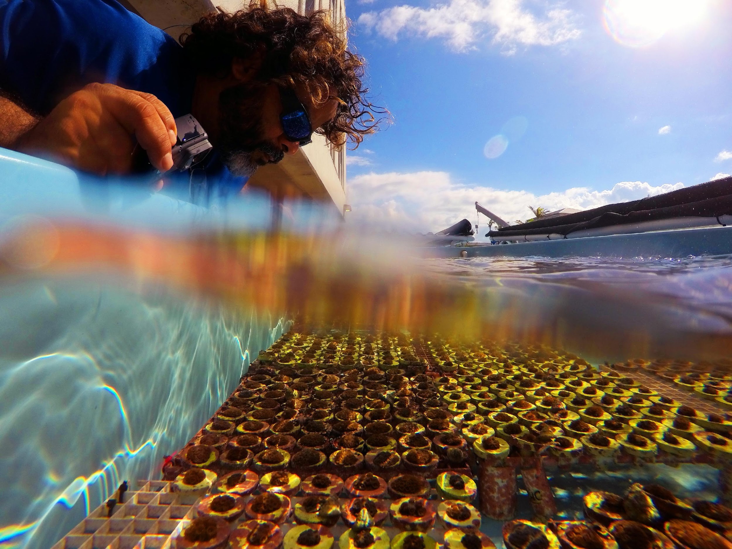
Emmanuel Irizarry-Soto observes microfragmented boulder star corals in the nursery. Photo © The Nature Conservancy
With this information, TNC coral scientists can monitor changes in the reef, such as rugosity (the three-dimensional arrangement of the reef structure), disease, coral growth, and loss. These data are essential for quantifying coral reef habitat restoration impacts in time and space and to enable comparison of changes to the reef structure in restored versus unrestored sites. Analysis of the effects of restoration on structural complexity and rugosity are especially pertinent for coral restoration projects that aim to maintain or enhance reefs for coastal protection and essential habitat for fishes and other reef-associated organisms.
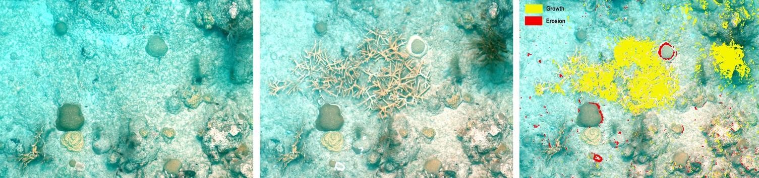
An example from Cane Bay, St. Croix, US Virgin Islands of how Structure-from-Motion data collected at different time points (Left to Right: April to August 2019) allows operators to detect powerful growth and erosion change using both the photomosaic and digital surface models. Left: pre-outplanting. Center: post-outplanting. Right: change detection showing accretion/growth (yellow) and erosion (red) following coral outplanting. Images © The Nature Conservancy
In the USVI, this monitoring approach and technology continues to be developed to meet the needs of different restoration projects. For example, photo collection methods are adapted to the parameters of a given site (shallow versus deep, transects versus plots) and algorithms are being iterated to derive the metrics that are most useful for measuring change.