Allen Coral Atlas
The Allen Coral Atlas is a game-changing coral conservation tool developed in partnership with coral reef scientists, universities, NGOs, and private entities. It was named for Microsoft co-founder and philanthropist Paul G. Allen in recognition of his key role in bringing the Atlas to life and his overall commitment to filling data gaps necessary to solve the world’s greatest challenges. From satellite imagery, in partnership with Arizona State University and the University of Queensland (UQ), the Atlas team is generating high resolution spatial and thematic maps of coral reefs worldwide. The innovative approach to mapping coral reefs, developed by UQ’s Remote Sensing Research Center, allows any shallow (down to 15 m) tropical coral reefs to be mapped and classified. These will be the first high resolution (5 m) maps of coral reefs created using a consistent methodology across the globe, providing both a geomorphic and benthic classification. These 5 m resolution maps will be comparable at local, national, regional, and global scales.
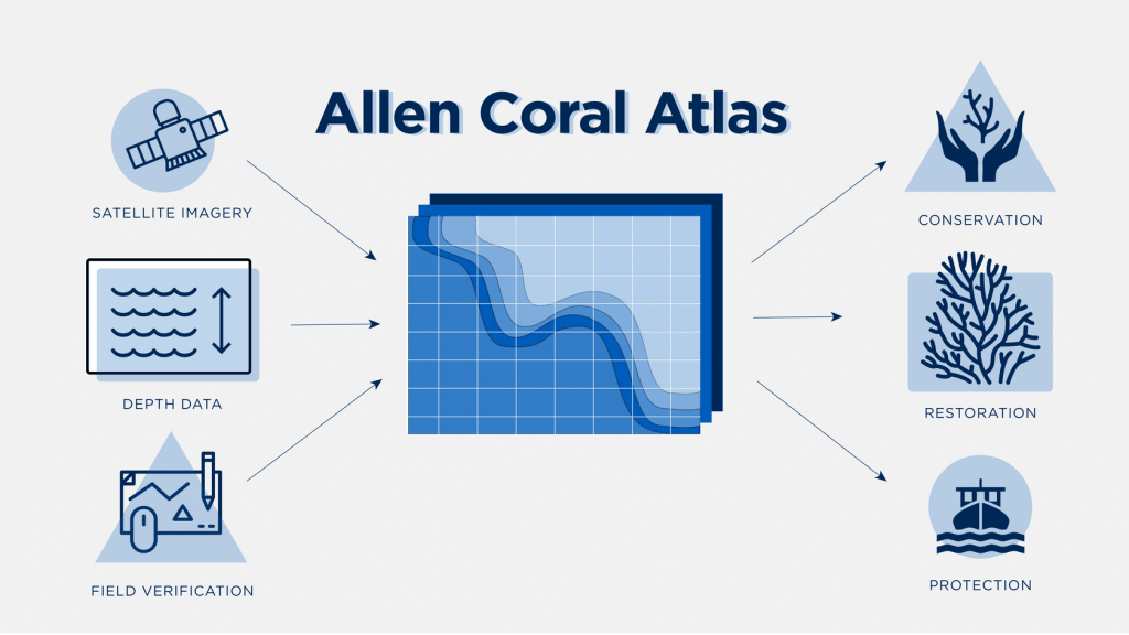
The unique approach of the Allen Coral Atlas to mapping coral reefs is a combination of satellite imagery, depth data, and field verification. It creates high resolution, high quality maps of coral reefs worldwide which are valuable for many applications such as coral reef conservation, coral reef restoration, and the protection of fisheries. Image © Vulcan Inc.
You can find more information on the Atlas, including a description of the methods to create the maps here.
Using the Allen Coral Atlas
The Allen Coral Atlas website features the Atlas interactive mapping tool, giving access to the satellite imagery, the geomorphic and the benthic maps of coral reefs worldwide. The Atlas interactive mapping tool provides features that allow simple analysis as shown in the video below.
The document Reef Cover Classification describes the classification used for the geomorphic zonation and the benthic classification. The geomorphic zonation is summarized in this infographic. The Atlas describes the application of remote sensing to map coral reefs at scales that address national and regional issues. The data addresses large-scale management questions, for example “What area of coral reef is protected by marine protected areas (MPAs)?”. The geomorphic and benthic maps of the Atlas can be used in many management applications. For example:- Marine spatial planning at a national and regional scale
- Monitoring and evaluation at a national and regional scale. Read the case study below
- Mapping coral reef resilience indicators
- Science/models: reef connectivity and seascape connectivity
- Coastal hazards and risk analysis
The maps of global benthic and geomorphic classifications of coral reefs generated by the Atlas team are a welcome addition to the libraries of existing coral reef maps. The coral reef maps generated by the Atlas team will be the first worldwide maps of coral reefs created using the same methodology, and providing both a geomorphic and benthic classification. These 5 m resolution maps will be comparable at local, national, regional, and global scales.