What is Remote Sensing?
Principles of Remote Sensing
Remote Sensing involves an interaction between light and the object of interest (coral, tree, field, etc.). There are six main components:
- A source of light – either from the sun or artificial
- An object of interest (e.g., coral, tree, house)
- A sensor mounted on a platform (e.g., satellite, plane, drone), that gathers radiation emitted or reflected by the object of interest
- A receptor on earth or in space that will receive information from the sensor
- A system to translate the remote sensing information into data
- Experts that can translate data into maps
See the graphic below for a representation of a passive satellite based remote sensing system.
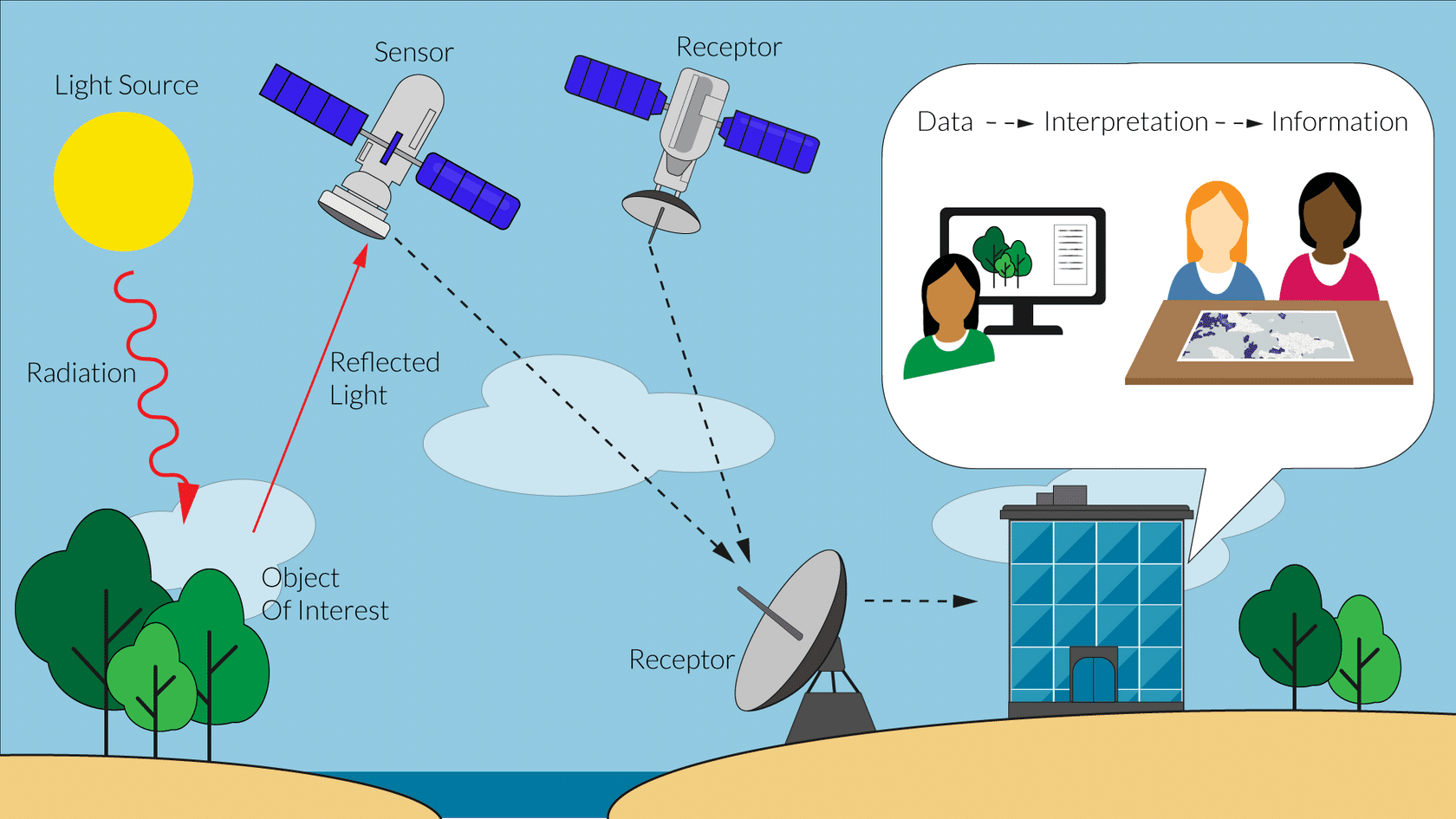
Example of a passive satellite based remote sensing system. Image © The Nature Conservancy
Remote sensing is based on the principle that there is always an interaction between electromagnetic radiation (light) and an object. Objects absorb, reflect, scatter, transmit, or refract radiation. Objects reflect radiation back at a remote sensor in different ways depending on their size, orientation, texture, color, or chemical composition.
For example, dry white sand has a high albedo and will reflect more light than wet, dark mud. It is the differences in reflection patterns that create unique spectral signatures and allow differentiation of habitats, objects, or even textures.
The reflected wavelengths are detected by sensors and transformed by computers into data. This makes it possible to gather information beyond just imagery, such as temperature, chemical composition, height, or moisture content remotely at large spatial scales. Experts with remote sensing and mapping skills translate the computer-generated data into maps. The maps are ready to be used by non-experts for applications such as participatory mapping which combines local knowledge and geographic data.
Types of Sensors
Sensors are categorized as either active or passive depending on their light source. They can be mounted on different platforms such as satellites, airplanes, or even drones.
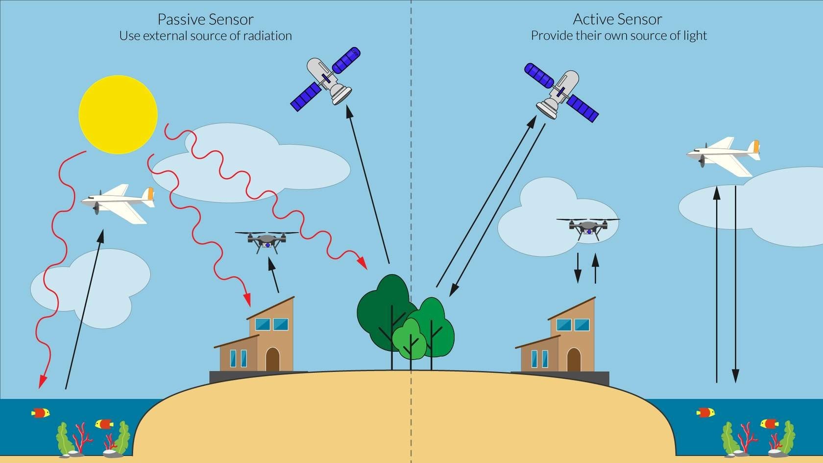
Difference between passive and active sensors for remote sensing. Image © The Nature Conservancy
Passive Sensors record natural energy that is reflected or emitted from the Earth's surface. The most common source of radiation detected by passive sensors is reflected sunlight. An example of a passive sensor is a camera with the flash turned off.
Active Sensors provide their own source of energy, such as a laser or microwave electromagnetic radiation, to illuminate the objects they observe. An active sensor can operate day and night by emitting radiation in the direction of the target to be investigated. An example of an active sensor is a camera with the flash turned on.
Spectral Signature
Satellite and aerial imagery is made of pixels, organized in a grid, like an image acquired from your digital camera. Each pixel contains numerical information representing the brightness of each area with a numeric value. Sensors will capture the brightness of an area at different wavelengths. For example, the sensor on the satellite WorldView 2 captures images using nine bands at different wavelengths compared to Planet Dove sensors that only use four. The WorldView 2 sensor has a higher spectral resolution.
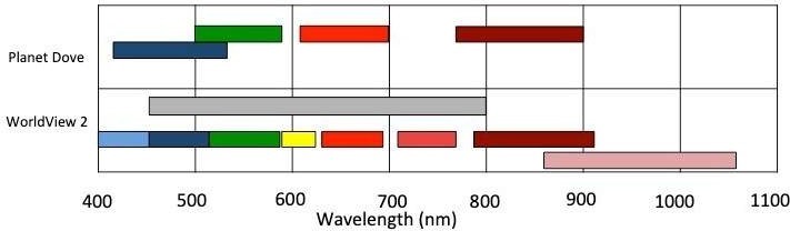
Comparison of the spectral resolution between Planet Dove’s multispectral sensor (4 bands) used to capture coral reef imagery for the Allen Coral Atlas and WorldView-2’s multispectral sensor (9 bands). WorldView-2 has a higher spectral resolution. Image © DigitalGlobe
Each object on Earth has a unique spectral signature, a unique way of reflecting light. The more spectral bands the sensor has, the better it will be at capturing these spectral signatures and showing reflection differences between objects.
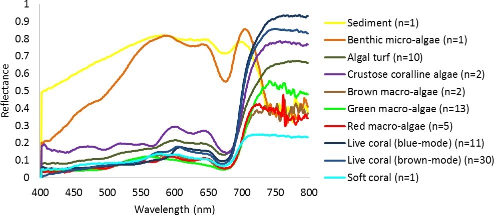
Spectral signature of different benthic and substrate classes measured underwater at Heron Reef, Australia. N is the number of samples measured to obtain the curve. Source: Leiper et al. 2014
Which bands are the most useful for mapping underwater features such as coral reefs?
Water absorbs the majority of incoming radiation across wavelengths within the first meter of depth. The only wavelengths that can penetrate the water column further are the visible bands, coastal aerosol, blue, red, yellow, and green. Red light is absorbed first, followed by green, then blue light which limits the observation of underwater features the deeper you go, even in the clearest water. From these visible bands, we try to extract the spectral signature of underwater features such as corals, algae, and seagrass.
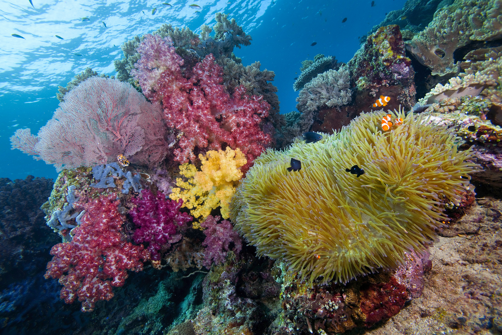
The vibrant colors of a reef. Photo © Jeff Yonover