Island Scale Mapping
A Mapping Tool for Outplanting Corals
Many coral reef management questions are centered around reef health such as “what reef area has better live coral cover?” or “what reef area meets certain criteria to enhance coral restoration success?”. Multispectral satellite imagery is still too coarse to be able to differentiate coral cover from algae, which has a similar spectral signature. One solution is to use imaging spectrometer data (also called hyperspectral data). With hundreds of spectral bands, these data are able to capture the subtle spectral signature variations between coral and algae, making it possible to differentiate them. Imaging spectrometers can be mounted on planes to collect data across large areas (see image below). The scale of projects which are adapted to this mapping approach usually span a few tens of kilometers, covering small island nations or sections of reefs. Due to their small size and small reef area, the islands in the Caribbean are ideal candidates for this technology.
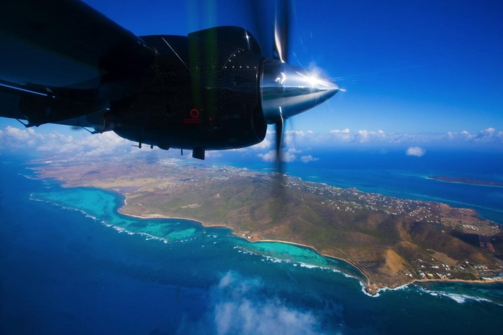
View of St. Croix from the Global Airborne Observatory plane. Photo © Marjo Aho
The Arizona State University’s Global Airborne Observatory (GAO) in partnership with The Nature Conservancy have collected imaging spectrometer data to derive qualitative coral reef data, including live coral cover, rugosity (the three-dimensional arrangement of the reef structure), and bathymetry. This process also produces ancillary datasets including percent algal cover, seagrass cover, and sand cover. View and use the maps on the Caribbean Marine Maps website: Airborne Imagery Maps.
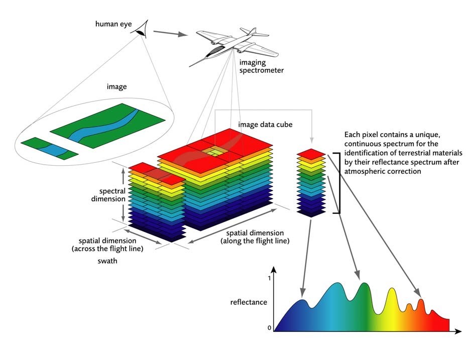
Imaging spectrometer mounted on a plane collecting hyperspectral data. Source: Knaeps et al. 2006
The GAO maps are being used to select outplanting sites in southeastern Dominican Republic by providing information on logistical and ecological criteria to increase outplanting survival rates as described in the case study below.
Case-Study: Using Remote Sensing Technology to Inform Outplant Selection in Bavaro, Dominican Republic
Restoration efforts in the Dominican Republic have been led by Fundación Grupo Puntacana (FGPC) and Fundación Dominicana de Estudios Marinos (FUNDEMAR), in close collaboration with TNC. As coral restoration practitioners, their programs focus on enhancing ecosystem services for the future, optimizing and scaling-up restoration, promoting coral reef conservation stewardship and providing alternative, sustainable livelihood opportunities. Their overall goals are to reduce coral population decline and ecosystem degradation and to re-establish a self-sustaining, functioning reef ecosystem. Most of these objectives have been accomplished through asexual propagation of Acropora cervicornis, staghorn coral.
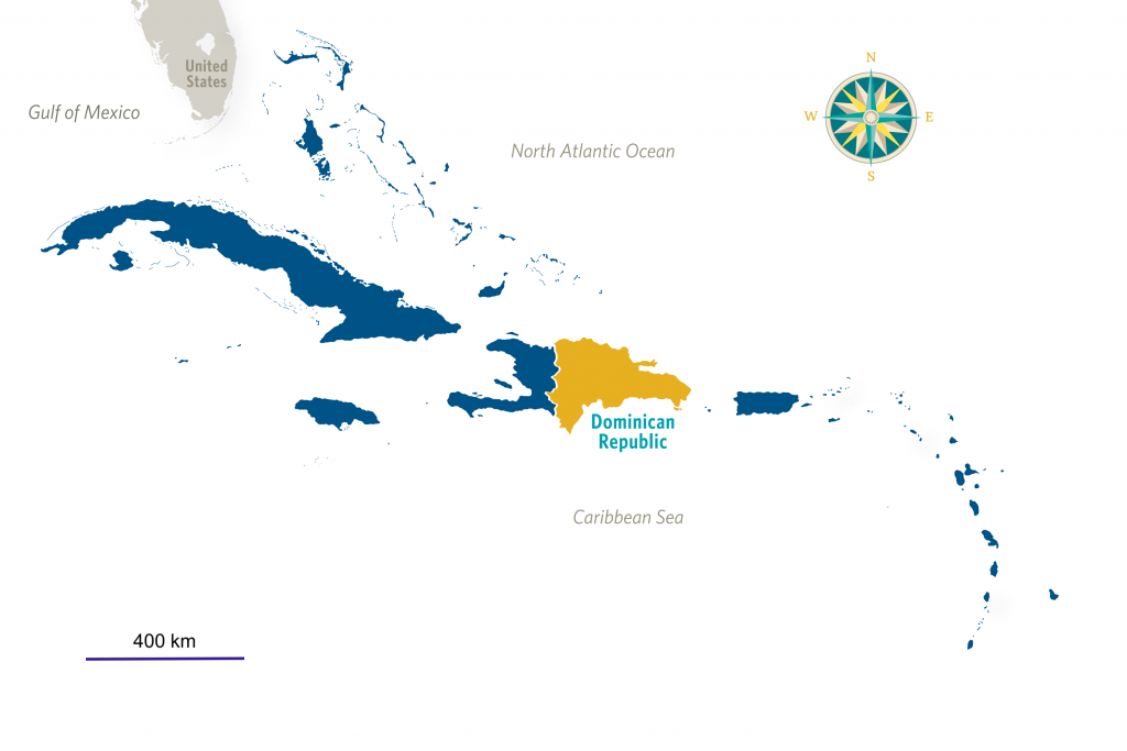
Map of the insular Caribbean highlighting the Dominican Republic. Image © The Nature Conservancy
FGPC and FUNDEMAR have organized massive outplantings called “Coral Manias” in which stakeholders and volunteers, including local and international NGOs, diving operators, the tourism sector and the Dominican Government, are engaged in three days of coral restoration efforts. Although Coral Manias have been successful, the selection of the outplanting locations has lacked standardized criteria for site selection. Instead, selection criteria rely on local expertise, which restricts the outplanting effort to small sections of the reef. To build a cost-effective approach to outplanting site selection and to scale up restoration success, remote sensing is being used to identify optimal sites for coral restoration.
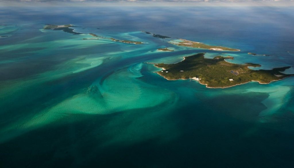
Aerial view of Dominican Republic. Photo © Jeff Yonover
In 2019, TNC and the Global Airborne Observatory (GAO), in collaboration with FGPC, FUNDEMAR and the Red Arrecifal Dominicana (RAD), created a series of high-resolution maps for the southeastern reefs of the Dominican Republic, covering the Southeast Marine Sanctuary. The GAO uses an imaging spectrometer sensor that collects high-resolution (1 m) images of coral reefs. High-resolution maps are derived from these data representing bathymetry, live coral cover, habitat complexity, and percent cover of algae, seagrass, and sand.
The GAO maps are being used to select outplanting sites in southeastern Dominican Republic. Logistical and ecological criteria were used in close consultation with local coral experts, to maximize the budget and increase outplanting survival rates. Two logistical criteria aimed at facilitating the outplanting process and reducing time, and therefore, costs in the field:
- Distance between the nursery and the outplanting site (>1000 m)
- Wave exposure (protected back reef habitats were prioritized)
Five ecological criteria were considered to enhance the probability of survivorship of outplants:
- Hard bottom habitats
- A minimum of 5-10% live coral cover
- A maximum of 20-30% algal cover
- Higher rugosity based on modeled habitat complexity (avoid flat habitat)
- Depth between 5-8 m
Once the criteria and their intervals were decided, the GAO maps were used to find a set of sites that best matched the criteria. Using the Outplanting GEE app, each of the input layers can be visualized and criteria thresholds defined. In this way, users can screen out areas that don’t meet the criteria and optimal outplanting sites can be selected. A series of GPS coordinates were generated days before the Coral Mania event and each site was verified for criteria accuracy using SCUBA and snorkeling.
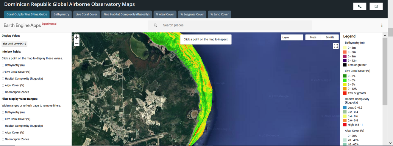
Online tool of GAO-derived maps for the southeastern reefs of the Dominican Republic where ecological criteria can be selected to maximize coral outplant success. Image © The Nature Conservancy
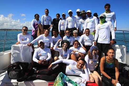
Coral Mania team in Bavaro in 2019. Photo © The Nature Conservancy
The November 2019 Coral Mania event brought together dozens of volunteers, including NGOs, Dominican environmental authorities, dive operators, and other local stakeholders. Together 1,711 Acropora cervicornis fragments were outplanted across sites in Bavaro (Cabeza de Toro). Visual inspections confirmed that the sites selected for outplanting fulfilled the logistic and ecological criteria, further showing that GAO maps are useful tools to target restoration sites.
This case study shows that remote sensing data are a useful tool for informing best restoration practices. GAO maps were accurate enough to select sites that will likely increase survivorship of coral outplants. In January and October 2020, TNC monitored the outplants in three randomly selected sites and confirmed 85% survivorship of coral fragments. The survey team did not find evidence of fragments detached from the substrate which further indicated the outplant suitability of the selected sites. However, long-term monitoring of these outplants is needed to better address and refine the criteria and restoration success.
Coral restoration cost has been estimated from $1,717 up to $2,879,773 USD per hectare ref and research suggests that current costs outweigh benefits. ref The use of remotely sensed data can be economically incorporated into restoration activities as high-resolution data can be collected from airborne mapping of large areas (thousands to millions of hectares) with costs $0.01 USD per hectare at non-profit rates. ref The major challenge to replicate this case study is to have the maps in hand, but once they are developed, using the selection site tool is simple.