Regional Scale Mapping
Insular Caribbean
Reefs are incredibly different from one region to another. A reef in the Caribbean will have different dominant coral, seagrass or algae species, ecological functions, and habitat connectivity than reefs in the Maldives or in Indonesia. In collaboration with local partners, the Atlas maintains locally mapped reefs that provide more detailed classifications adapted to the local habitats and management needs.
In the case of the insular Caribbean (The Bahamas, the Greater Antilles, and the Lesser Antilles), The Nature Conservancy has partnered with the Atlas, Vulcan, Planet, and Arizona State University (ASU) to develop a set of high-resolution (4 m) custom-made benthic maps for subsets of reefs that reflect the uniqueness of the region. These maps were developed to provide seamless and uniform spatial data at a regional and national scale.
The Caribbean Benthic Habitat Maps contribute to conservation and research projects including marine spatial plans, ecosystem services modeling, ecosystem-based adaptation, and blue carbon initiatives. Learn more about these projects at the Caribbean Science Atlas.
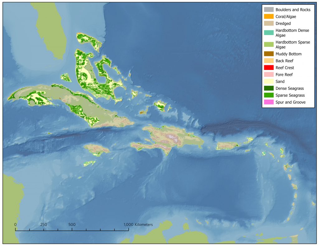
Footprint of the Caribbean Coral Reef Benthic Map. Credit: The Nature Conservancy
The Caribbean Benthic Habitat Maps are based on high-resolution satellite imagery from the PlanetScope SmallSat constellation. To classify the satellite imagery and generate the benthic coral reef maps, TNC has developed a unique classification scheme tailored to the Caribbean.
View and use the maps on the Caribbean Marine Maps website: Satellite Imagery Maps.
A short video demonstrates how to navigate to the Caribbean Benthic Habitat Maps and how to use the online mapping tool to explore them.