Coral Reefs
Creating maps of coral reefs at a global scale requires collaborative work and the integration of information at various scales. Here we present the process used by the Allen Coral Atlas to map all the coral reefs worldwide. You can learn more about the process and the Allen Coral Atlas in the course Remote Sensing and Mapping for Coral Reef Conservation.
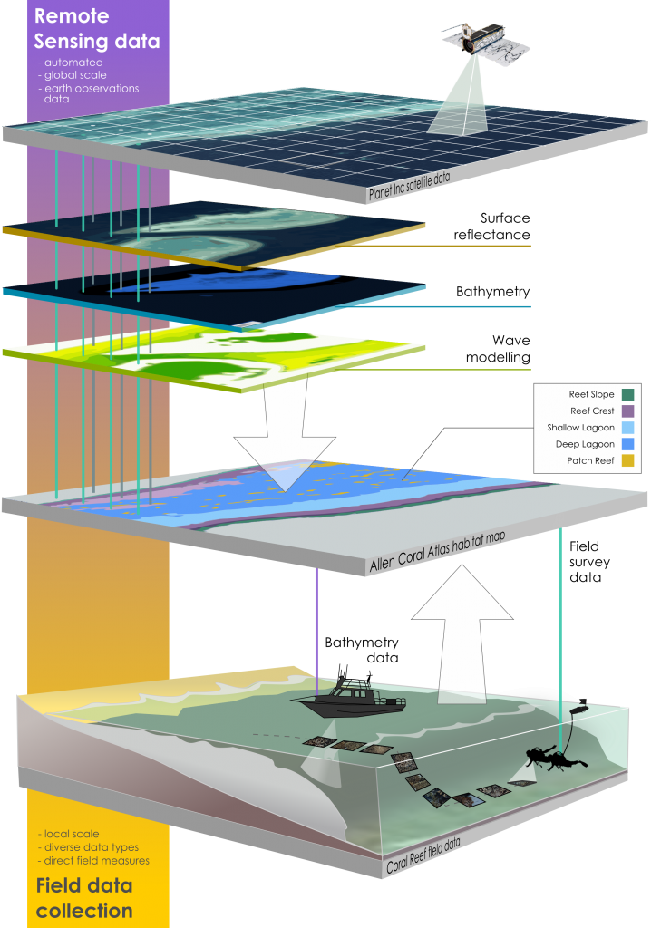
Summary of the process to classify the satellite images into maps of coral reefs worldwide, from satellite imagery to field data. Source: Kennedy et al. 2020
The process used by the Allen Coral Atlas team to classify remote sensing images into maps can be summarized into three stages:
- The collection of global-scale information accessible from optical satellite sensors.
- The integration of local scientific knowledge on coral reef systems as training and validation objects into the remote sensing data.
- The creation of geomorphic and habitat type classification to inform coral reef management.